A granite island in the English Channel, with wide western bays, sheltered eastern harbours, high southern cliffs and fast tides running between the islands.
5-minute guide
Today, Thursday 8 October
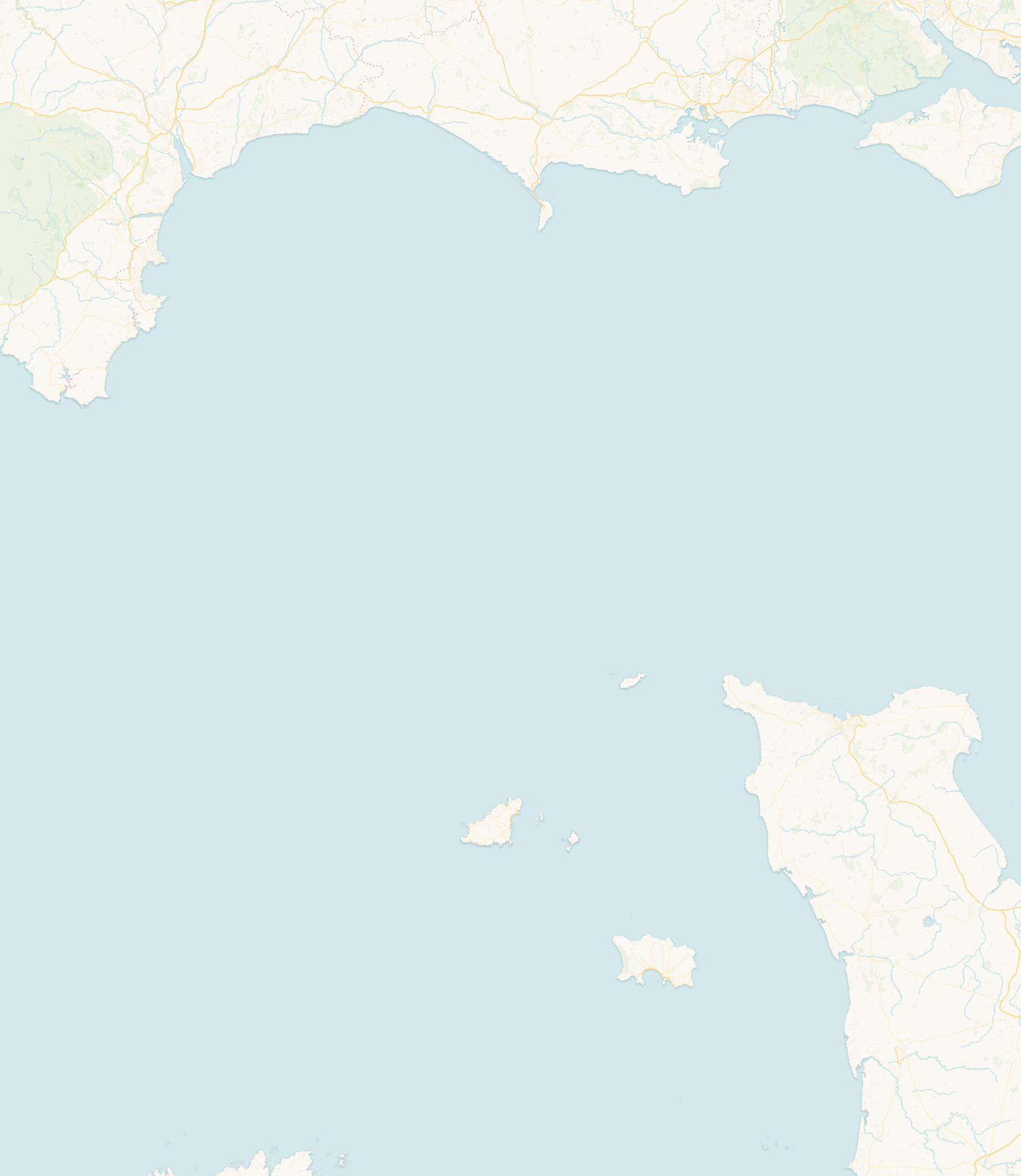
Guernsey is the second largest of the Channel Islands and the principal island of the Bailiwick of Guernsey. It lies in the English Channel off the Cotentin peninsula of Normandy, much closer to France than to mainland Britain, and is a British Crown Dependency rather than a part of the United Kingdom.
The bailiwick also includes Alderney, Sark, Herm, Jethou and Lihou, along with many smaller islands and reefs. St Peter Port, on the east coast, is the main town and harbour and the arrival point for most visitors by sea.
For a small island, Guernsey’s coastline changes character remarkably from side to side, and each coast behaves differently in wind, swell and tide.
The west faces the Atlantic with long sandy bays such as Cobo, Vazon, Grandes Rocques and Port Soif, big sunsets and wide rock platforms that appear at low water. The north, around L’Ancresse and Pembroke, is lower and more open, backed by common land and dunes. The east, sheltered in many conditions, holds St Peter Port, Havelet Bay and the bathing pools, and looks out towards Herm and Sark. The south rises into the island’s highest cliffs, cut by wooded valleys into small coves like Moulin Huet, Petit Bôt, Saints Bay and Fermain.
Guernsey is often called a granite island, although its rock is more varied than that suggests. Much of what is loosely called granite here is in fact gneiss, an ancient banded rock, alongside true granite and darker crystalline rocks such as gabbro and diorite. The island divides roughly in two: an older, higher southern half and a lower northern half, each built from different stone.
These hard rocks give the coast its shape. In the south, the old gneiss rises into steep cliffs and headlands cut by wooded valleys into small coves. Around the rest of the island the same resistant rock forms reefs, rocky shelves and the platforms that lie beneath many of the sandy bays.
At low water much more of this landscape appears. Rock platforms, gullies and reefs emerge well beyond the usual shoreline, especially on the west, north and east coasts. They can be fascinating to explore, but the returning tide does not advance in a straight line: water fills channels and slips behind rocks before the open shore looks much changed.
Stone shaped the island above the tideline too. Local granite and related rock built its houses, harbour walls and coastal forts, and in the nineteenth century quarrying in the northern parishes grew into a major industry, exporting Guernsey stone across the Channel.
The water around Guernsey moves quickly. It helps to separate two things: the tidal height (how far the sea rises and falls, over 9 metres on the biggest spring tides) and the tidal current (how fast the water flows past the coast). A bay can look calm at the surface and still have a strong current running offshore.
The state of the tide changes the island by the hour. West-coast beaches grow enormously at low water; south-coast coves can shrink or be cut off near high water; and the causeway to Lihou only opens for part of the tidal cycle. Checking the height and the time of the turn is part of using the coast safely, always alongside the wind, the swell and how much daylight is left.
The tide reshapes the shore through the day. The predicted height is only part of the picture: wind, air pressure, waves and the shape of each bay all change what you actually find at the coast.
Many western and northern beaches become considerably wider, and reefs, rock pools and gullies appear around the edge of the sand. This opens up long stretches of coast to explore, but it also reveals channels that refill quickly once the tide turns.
Water moves through gullies and around rocky outcrops, and can cut off a route before the main beach looks covered. On a gently shelving beach the change may seem gradual; around reefs, headlands and small coves it can be far less predictable.
There may be little beach left at some bays and coves, and waves can reach sea walls, rocks or the foot of the access steps, particularly when high water meets strong wind or swell.
Sand and rock gradually reappear, but newly uncovered surfaces stay wet and slippery. A falling tide can give more room on the shore, though the current and any swell may still be significant.
People have lived on Guernsey since prehistory, and dolmens such as Le Déhus and La Varde still stand. When King John lost continental Normandy in 1204, the islands kept their allegiance to the English Crown, and that Norman-to-Crown story still shapes the island’s law and identity today.
Later centuries brought maritime trade and privateering, granite quarrying, and waves of coastal fortification: Napoleonic-era loophole towers, Victorian defences and the extensive German works of the 1940–1945 Occupation. Liberation on 9 May 1945 is still marked each year.
English is the everyday language, but Guernsey’s traditional Norman language, Guernésiais, survives in place names, surnames and among a small number of speakers. Parish identity runs deep, and local traditions include Guernsey gâche and bean jar, the island’s own breed of cattle, and Liberation Day.
No. Guernsey is a British Crown Dependency with its own parliament and laws. It is not part of the United Kingdom and never has been part of the European Union in its own right.
France. Guernsey lies off the Normandy coast and is considerably closer to France than to mainland Britain.
About 78 square kilometres (30 square miles), roughly 9 miles long by 6 miles wide.
No. They are separate islands and separate bailiwicks, each self-governing, about 25 miles apart.
Yes, across a tidal causeway from L’Erée on the west coast, but only for a window either side of low water; the causeway is covered at high tide. Check the published crossing times before you set out, allow a safe margin to get back, and take account of the weather and sea state.
Yes. The sea can rise and fall by more than 9 metres on the largest spring tides, and the currents around the island are strong.
This guide draws on information from official island authorities, local heritage and environmental organisations, and recognised coastal and hydrographic sources.
Last reviewed: July 2026. Geographic, historical and coastal information has been checked against official and authoritative local sources. Tide predictions remain forecasts, and local conditions can vary.
Check today’s high and low waters before heading to the shore, or open the full Guernsey tide table.
 Guernsey